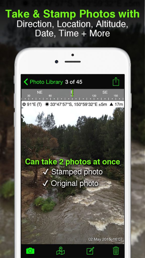
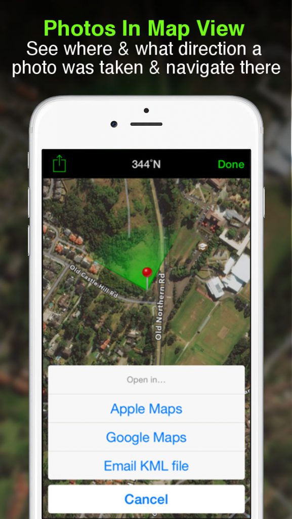
Solicitor is a GPS camera for fieldwork. Overlay and stamp photos with GPS location, compass direction, altitude, date & time taken + with Industry Pack (IAP) capture editable notes such as project name and photo description, street address, and UTM/MGRS coordinate formats. It can auto-save 2 photos to the camera roll at once – A stamped photo and an original high-res photo. You can also view photo directions and locations in map view and navigate there. So now you will always know where and when a photo was taken and how to get back there.
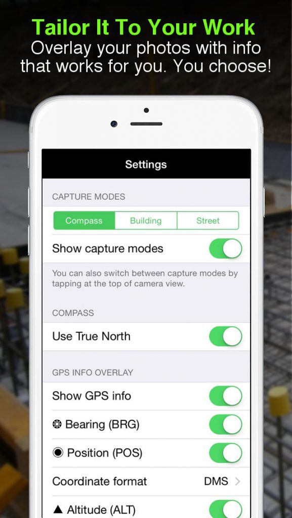
TAILOR THE INFO YOU CAPTURE
You can choose what information you want to overlay on your photos to suit your fieldwork.
Choices include:
– GPS Location (Latitude & Longitude in various formats) ± Accuracy
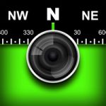
– Compass Direction – Bearing
– Altitude (Metric & Imperial units)
– Date & time
– Show Compass
– Show Cardinal points in Building mode; e.g. North or South Elevations of a building face.
– Option to use abbreviations or Unicode characters for direction, position, and altitude.
WORKING WITH CAPTURED INFO
– Options to take and auto-save two photos to Camera Roll at once; one with stamped info and the other as an original high-resolution photo.
– Photos are sorted by time, location, distance from the current location, and project name (if Industry Pack purchased).
– View photo direction and location in map view and navigate there
– Save photos with metadata in Exif format to the camera roll
– Share photos on Facebook & Twitter
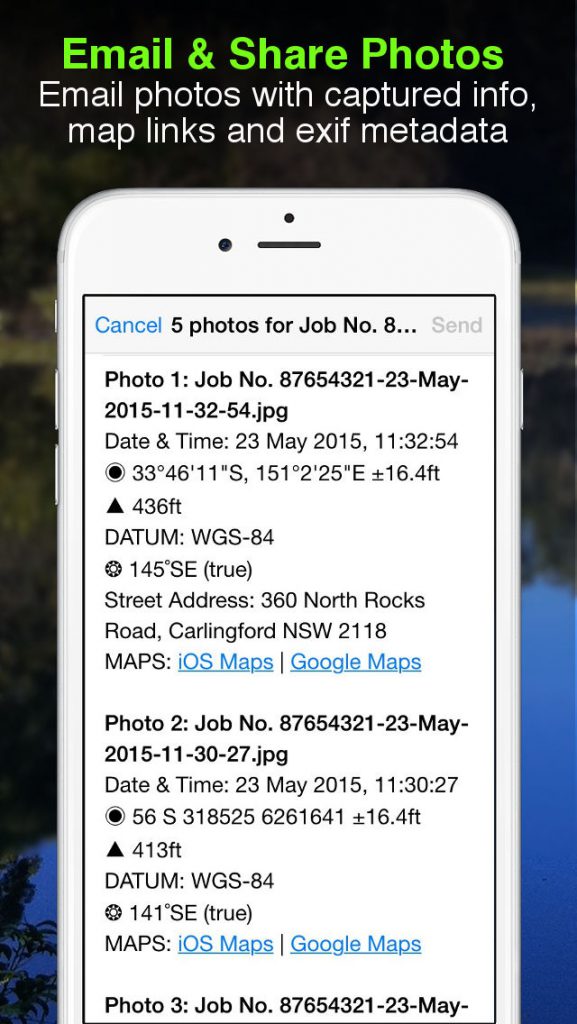
– Email photos from within the app including:
• Exif metadata
• Compass Direction
• GPS Position ± accuracy
• Altitude
• Date & Time taken
• Street address (if selected)
• Elevation of building face viewed (if selected)
• Links to maps so the receiver can navigate there easily
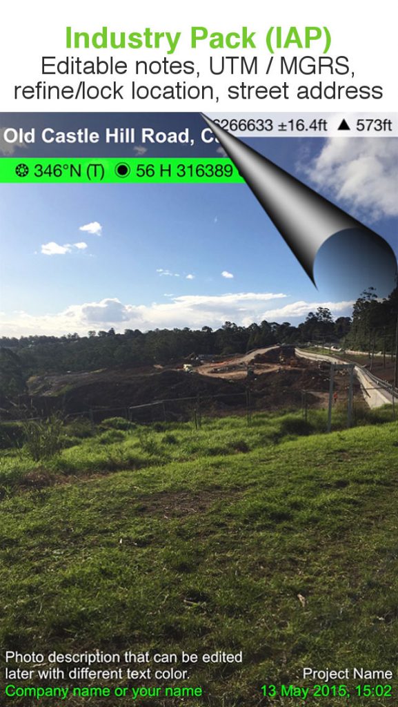
INDUSTRY PACK (In-App Purchase)
REFINE AND LOCK GPS LOCATION
Ideal for those working in and around buildings; to improve their GPS location. You can also use it to lock the position of the asset or subject you’re photographing as opposed to where you’re standing.
EDITABLE NOTES
Stamp your photos with “Project name” & “Description”. The project name field could be used as a job or policy number etc. You can also go back and amend the project name or description or just add the notes later when you’re in the office.
PROJECT NAME USED AS FILE NAME PREFIX
Photos taken with the project name at the time of capture are saved with a prefix, which works with photos emailed. Photos with a project name will also be sorted and grouped by project name. Project names are also automatically used as email subject lines.
SWITCH OFF CAPTURE MODES – GREATER FLEXIBILITY
Switch the Compass, Building, and Street modes off and just show the GPS info bar on top of the photos. Gives you more flexibility on what and how you overlay info and show more of the photo.
YOUR WATERMARK
Customize your photos by stamping your watermark. e.g. company name, team, or photographer name.
STREET MODE
Selecting street mode overlays photos with street address.
Email KML file of photo location