Your iPhone or WiFi+Cellular iPad becomes a high-performance GPS receiver with USGS & US Forest Service topo maps, even where there is no cell signal!
Headed into the wilderness? Buy this app now so you will always know where you’ve been, where you are & where you’re going. Highest quality track recording, best route navigation & most accurate Estimated Time of Arrival of any available hiking app. No sign-up, ads, subscription or in-app purchase required, making this less expensive & less hassle than the “free” or subscription apps.
Use for hiking, biking, skiing, backpacking, canoeing, kayaking, geocaching & 4WD exploring. Recommended as the top choice in “Essential Gear for Safe Hiking”.
TRACKS, WAYPOINTS & ROUTES
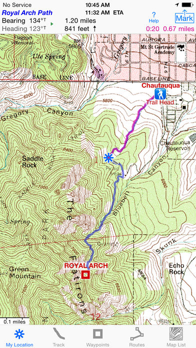
? Record a track as you walk, even in the background. View it on the map. Trip Timer & Odometer
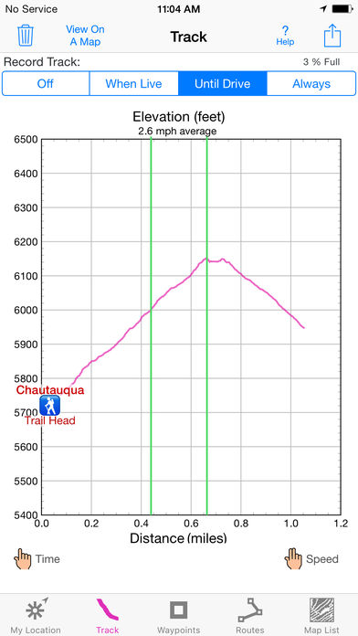
? Show an elevation graph of your track or a route with altitude data. View date, time & average speed of track points. Display the area inside a closed path
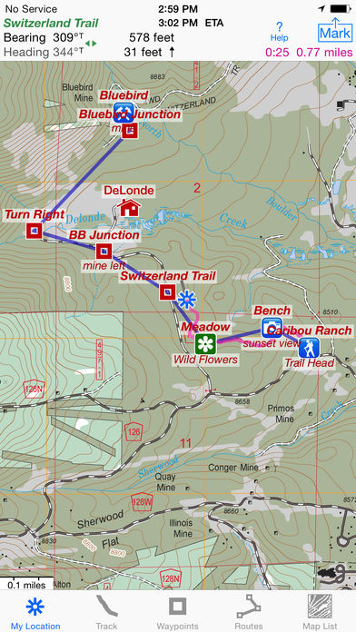
? Mark waypoints by their position on a map, by tapping a geotagged photo, by projecting from a known point or by searching place names. Refine a waypoint position when you arrive
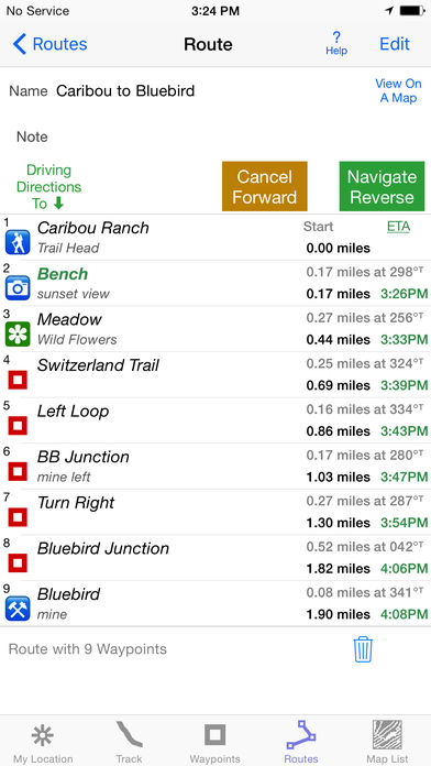
? Set a quick GoTo waypoint or a full route & see the heading, direction, distance, elevation change & Estimated Time of Arrival at your destination & intermediate waypoints along the trail
? Create & edit routes using waypoints or recorded tracks
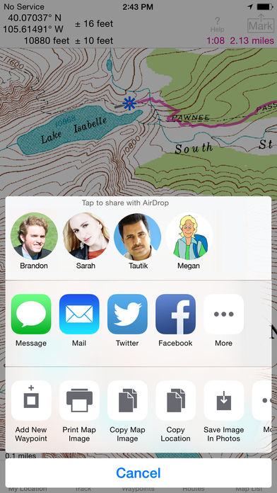
? Export & Import GPX & KML waypoint, route & track files via eMail, Messages, Copy To, AirDrop, iCloud Drive, Dropbox or iTunes
? Send KML files to display immediately in Google Earth
? GPS+Glonass satellites & Barometric Pressure Sensor improve accuracy in challenging terrain & reduce elevation data noise on iPhone 6, iPad Air 2, iPad mini 4 & later
FOREVER-FREE TOPO MAPS
? USA: Newest (2015) US Forest Service 24K maps
USGS 24K classic maps for all 50 states, Guam, Puerto Rico & the US Virgin Islands
USGS 250K & 100K (63K for Alaska) maps for all states
? Canada south of 54° latitude: National Resources Canada 50K maps for Alberta, British Columbia, New Brunswick, Nova Scotia & Prince Edward Island
? Stitches beautiful richly detailed offline topographic map images for seamless coverage across map boundaries
? Includes map legends
? Store up to 750 maps to use in the wilderness without cell service. Maps from our server download faster, use less of your monthly data allotment & use less memory
? Print & Share map images overlaid with waypoints, routes & tracks
SET IT UP AS YOU LIKE
? miles, nautical miles or km. ft or meters
? Degrees, Degrees/Minutes, Degrees/Minutes/Seconds or UTM
? °True or °Magnetic
HOW TOS
? Tap Help in the App
? Online Manual on iHikeGPS.com
? Follow on Twitter: @iHikeGPS
? Email developer: [email protected]
WHAT OTHERS SAY
? “I am VERY impressed!!!…It pretty much blows…, my previous fave GPS app, out of the water. Your track recording features, fast map downloads, and well thought out interface make it a real winner. It’s very sophisticated software, and makes my iPhone just about as good as $600 Garmin… Actually better, in a lot of ways”-John in OR
? “Perfect for anyone camping, fishing & hiking, it’ll provide great detail when you need it the most…for anyone who takes the great outdoors seriously”-David on HandheldItems.com
? “…thank you for developing IHIKE GPS…what a great product it is. I am impressed!…I use it hiking, biking, skiing & Jeeping”-Ammon in CO
DEVICE REQUIREMENTS
? No device requires a cellular data plan to use iHikeGPS
? iPad 2 & later with WiFi+cellular & iPhone 4 & later support full navigation
? The WiFi-only iPad 2 & later, and the iPod touch (5th gen) & later require an iOS-compatible external GPS receiver to show your location in the wilderness & record tracks. View maps using the iOS device alone
? Continued use of GPS running in the background can dramatically decrease battery life
Your dream of hiking adventures reaches new heights with iHikeGPS
