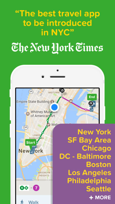
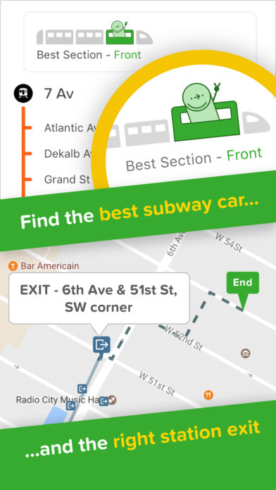
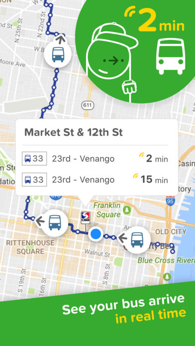
Real-time departures. Transit maps. Line status and real-time disruption alerts. Uber integration. Bike routing and live bike share info. Constant updates. Everything you need — and may not even realize you need — to manage your life in the city.
COVERAGE
USA/CANADA: New York City, San Francisco Bay Area, Los Angeles, Washington DC, Baltimore, Seattle, Chicago, Boston, Philadelphia, Toronto, Vancouver, Montreal.
ASIA: Singapore, Hong Kong, Seoul, Tokyo.
AUSTRALIA: Sydney, Melbourne.
EUROPE: London, Manchester, Birmingham, Paris, Lyon, Berlin, Hamburg, Brussels / Belgium, Amsterdam / Randstad, Madrid, Barcelona, Milan, Rome, Lisbon, Copenhagen, Stockholm, Moscow, St Petersburg.
LATIN AMERICA: Mexico City, São Paulo.
EXPANDING: VOTE for your city and we’ll add it citymapper.com/nextcity
PRESS REVIEWS
“Citymapper is, quite simply, the best travel app to be introduced to New York City” – New York Times
“Now forget about Google Maps because Citymapper eats Google Maps for breakfast, lunch, and dinner.” – Tech in Asia
MAIN AWARDS
* Apple’s 2014 and 2013 Apps of the Year
* Grand Prize Winner – MTA New York City App Quest 2013
* Best Overall Mobile App (Mobile World Congress Barcelona / GSMA 2014)
* Winner of Grand Prix, Best Transport Startup and Best Mobile Startup – 2015 Europas Awards
* Special Prize Winner – Tokyo Metro Competition 2015
THOUSANDS OF 5-STAR USER REVIEWS
* “Best app on my phone.”
* “It’s reason alone to get an iPhone. It’s that good.”
* “I’m practically married to this app.”
* “Don’t know how I lived without it.”
* “This app makes me warm inside.”
* “The only true five star app.”
* “Support for the SF Bay Area is particularly impressive because it aggregates all transit systems imaginable (BART, Caltrain, MUNI, VTA, etc.) into one seamless app.”
* “Best app for getting directions and ride on the MTA New York City.”
* “Life changing. This app really changes the way you travel.”
* “This is my favorite transit app. Full-featured and a breeze to use. I really appreciate the Uber integration.”
AVAILABLE CITIES & SERVICES IN THE US, SINGAPORE & HONG KONG
We use open data from transport agencies in the cities where we are live:
– New York City: MTA, MNR, LIRR, Nassau Inter-County Express (NICE), New Jersey Transit, NY Waterway Ferries, PATH, Citi Bikes
– San Francisco Bay Area: BART, MUNI, Caltrain, AC Transit, SamTrans, VTA, Golden Gate Transit, County Connection, Wheels, Union City Transit, Tri Delta Transit, WestCAT, Stanford Marguerite, Emery Go-Round, ACE, Capitol Corridor, Bay Area Bike Share, San Francisco Bay Ferry
– Los Angeles: Metro, Metrolink, Santa Monica Big Blue Bus (BBB), DASH / Commuter Express (LADOT)
– Chicago: CTA, ‘L’, METRA, PACE Bus, Divvy Bikes
– Boston: Massport, MBTA, Boston Commuter Rail, the ‘T’, Silver Line, Hubway Bike Share
– Washington DC: WMATA, DC Circulator, Metroway, Ride On (Montgomery County), ART (Arlington), DASH (Alexandria), Fairfax Connector, VRE, MARC Trains, MTA Commuter, Capital Bikeshare
– Philadelphia: SEPTA, PATCO, NJ Transit
– Singapore: LTA, SMRT, SBS
– Hong Kong: MTR, HK Tramways, Light Rail, Kowloon Motor Bus, Citybus, First Bus, First Ferry, Star Ferry, Discovery Bay Ferry & Bus, Park Island Ferry & Bus, Green Mini Bus
KEEP IN TOUCH
If you have questions or feedback, please email us at [email protected]
Like us on Facebook: http://facebook.com/thecitymapper
Follow us on Twitter: http://twitter.com/Citymapper
Visit our website: http://citymapper.com
Please note that the app requires data access and works best with GPS / location on. Also, continued use of GPS running in the background can dramatically decrease battery life. Background GPS is only used when in ‘GO’ navigation mode.
Related Apps

TransLoc Rider: Transit Tracking & Alerts
iWay GPS Navigation – Turn by turn voice guidance with offline mode

Waze – GPS, Maps, Traffic Alerts & Live Navigation

HondaLink Navigation NA

ETA – Arrive on time


